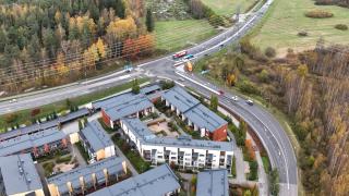
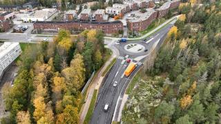
The work on the traffic management system of Ring Road III between Highway 1 Turunväylä and Motorway 170 Itäväylä will be completed shortly. The renewed traffic information displays will be introduced as soon as at the turn of September and October.
The renewed Fintraffic traffic management system comprises a total of 13 renewed traffic information displays with their own telecommunications and electricity supply systems. The new, changing displays will expand the range of traffic data shown to road users. For the first time in Finland, the traffic information displays will provide information about deviations in driving times. For this purpose, Fintraffic utilises not only its own traffic data but also the real-time situational information collected by Waze. In addition, as before, the information displays also provide information on weather and road conditions and on traffic disruptions.
“Our goal at Fintraffic is to provide as comprehensive a picture of what is happening in traffic right now as possible. The renewal of the Ring Road III traffic management system also provided an excellent opportunity to start utilising the data obtained via Waze for producing data content for traffic displays. In the future, when driving on the above-mentioned section of Ring Road III, the traffic information displays will provide motorists with data on deviations in expected driving times and advance information on congested road sections. This makes it possible to better anticipate traffic situations and help traffic run smoother,” says Jarkko Johansson, Service Manager at Fintraffic.
Fintraffic's goal is to establish an even more comprehensive data base for traffic system and logistics users than before. To do this, we need close cooperation with the various parties involved in transport. That is why we are building a traffic data ecosystem and developing platform services. Fintraffic is involved in the “Waze for cities” programme, where partners can use the traffic data collected by Waze and also share their own data with Waze. Waze uses Fintraffic's traffic bulletins through the Digitraffic open data sharing service for Fintraffic application developers.
Check out the new information displays here
Driving time information
When in the basic mode, the information displays show driving time information. The driving times are always displayed in the direction of traffic for Highways 1 or 7, for the next radial highway (highway 3 or 4) and for Ring Road I along the nearest radial main road.
The driving times are displayed as a change from the normal uncongested situation, e.g., delay to Highway 3 +4 min. If there is no congestion, the display shows +0 min.
Figure 1: An example of a display text shown to those driving in the eastern direction before highway 3
When weather and road condition information is active in poor driving conditions, the displays do not show delay times for Ring Road I.
Figure 2: An example of a display text shown to those driving in the eastern direction before highway 3 when the weather warning is shown on the display at the same time as travel time information
In slippery conditions, when the road temperature is below +5 degrees, only the road and air temperatures may be displayed if the traffic situation is quiet (the traffic volume is less than 500 vehicles/h in the direction of traffic) and there is no congestion (travel times are +0 min).
Congestion warning
When clearly reduced vehicle speeds are observed and traffic may keep stopping on the monitored road section after the traffic information display, the warning ‘Congestion’ will be displayed. In addition, an auxiliary sign below the warning sign will indicate either the distance to the site (Figure 3) or the length of the impacted area (Figure 4).
Figure 3: An example of a display text shown to those driving in the eastern direction before highway 3, distance to the congested area approx. 1.5 km
Figure 4: An example of a display text shown to those driving in the western direction before highway 3, length of the congested area approx. 2 km
Information on the running of traffic in the surrounding road network
The traffic information displays also provide information on any major problems in the running of traffic on the main roads crossing with Ring Road III if the problem areas are located in the vicinity of Ring Road III.
Figure 5: An example of a display text shown before highway 4
Figure 6: An example of a display text shown before highway 3
Weather and road condition information
Bulletins concerning deteriorated and poor weather and road conditions on the traffic information displays function in the same way as before.
Figure 7: An example of a display text in case of poor driving conditions
Figure 8: An example of a display text in case of poor visibility
Information on disruptions
The information on disruptions includes specific traffic disruptions that have a clear impact on the running and safety of road transport, such as accidents (Figure 9) and lane or road closures (Figure 10).
Figure 9: An example of a display text; accident on Ring Road III 2 km away
Figure 10: An example of a display text shown before highway 4; Highway 4 lane closed in the direction of Lahti
The renewal of the traffic management system is aimed at improving the operational reliability and maintainability of the system by renewing equipment at the end of their life cycle and replacing them with modern technology. The estimated technical lifecycle of the renewed system will be over ten years. Fintraffic Tie Ltd acts as developer and Caverion Suomi Oy as main contractor in the project.
Share
Read more


